THE GROUND UNDERNEATH: PART TWO
- kristin0214
- May 15
- 12 min read
Skinwalker Ranch, Data Centers, and the Pattern That Keeps Expanding
Fear and Wine Original Investigation | May 2026
When we published part one of this investigation, we expected questions. What we did not expect was the quality of them.
Within hours of the post going live, two threads emerged in the comments that we could not ignore. One reader asked whether the same geological pattern we documented at nuclear weapons facilities might also apply to commercial data centers. Another pointed directly at Skinwalker Ranch and asked a single question: does it sit on a rift zone?
We followed both threads. What we found extended the pattern further than we anticipated and raised questions we are still working through.
One correction before we begin. A reader with a background in radio physics correctly pushed back on language in the first post. We used the term ELF waveguide to describe what rift zone geology does. That framing was imprecise. ELF wavelengths are enormous, ranging from roughly 100 kilometers to 30,000 kilometers, and the ionosphere-Earth cavity is the true global propagation medium for ELF signals. Local geological features cannot act as waveguides at those scales. What rift zone geology does affect is different: ground antenna system efficiency, passive electromagnetic detection sensitivity, and magnetotelluric subsurface imaging capability. We updated the first post and this one uses the correct framing throughout.
If you have not read part one, the short version is this. Los Alamos National Laboratory sits adjacent to the Pajarito fault on the active Rio Grande Rift. Kirtland Air Force Base sits directly over the Sandia-Rincon fault on the same rift. Wright-Patterson Air Force Base sits on the East Continent Rift Basin in Ohio. Minot Air Force Base sits adjacent to the Midcontinent Rift System. A private military-grade communications installation at Zorro Ranch sits at the geographic midpoint of that rift corridor. The full geological argument with sources is in part one. This piece builds on it.
Addressing the Obvious Counterargument First
Before presenting any new findings, we want to address the most important skeptical question, because it is the right one to ask.
Is this pattern real, or does every location in the United States sit on a rift zone?
The answer is no. The pattern is measurably real and geologically specific. But it is stronger in some regions than others, and intellectual honesty requires saying so clearly.
Large portions of the United States are geologically stable and do not sit on rift systems. The craton region of North America, the stable ancient core of the continent, covers the broad interior between the Rocky Mountains and the Appalachian Mountains. [Geosciences LibreTexts: craton definition, geo.libretexts.org] This includes most of the Interior Plains: Kansas, Nebraska outside Omaha, Iowa outside the rift margin, Indiana, most of Missouri, most of Illinois outside Chicago. These areas sit on flat-lying sedimentary rocks over ancient tectonically quiet basement with no significant rift features.
The Colorado Plateau covering much of Utah, Colorado, Arizona, and New Mexico outside the rift zones is documented as a stable region dating back at least 600 million years. [USGS Geology of the United States, en.wikipedia.org/wiki/Geology_of_the_United_States] The Atlantic Coastal Plain and the Gulf Coastal Plain are similarly not rift terrain.
The Midcontinent Rift System is real and mapped, but more than 90 percent of it is covered by younger rock and it follows a specific narrow corridor. [USGS, Geophysics of the Midcontinent Rift Region, usgs.gov] It does not cover the entire Midwest. Chicago sits on it. Kansas City does not. Indianapolis does not. St. Louis does not. The data center clusters that appear on our map sit on the rift corridor specifically, not on the stable craton surrounding it.
Here is where honesty requires a distinction. The argument is stronger for the eastern United States than for the western United States. The western US is broadly more faulted and tectonically active because of its geologic history. Silicon Valley and Phoenix sit in an actively extending region where faulting is widespread. You could argue that almost any western location sits near some fault system. That is a fair point and we are not going to pretend it is not.
But the eastern US cases are different and more compelling. Ashburn sits on a specific Triassic rift basin running through Loudoun County, surrounded by stable Piedmont geology that is definitively not rift terrain. Columbus Ohio sits on the East Continent Rift Basin, a specific and narrow buried feature, while cities 70 miles away on the stable craton have no equivalent data center concentration. Atlanta sits on the Brevard fault zone, a specific tectonic boundary, while the surrounding Georgia Piedmont is stable craton. The New Madrid seismic zone running through Louisiana is a specific mapped feature, not a general description of southern geology.
The eastern US data center pattern is the stronger half of the argument, and it is the half where coincidence is hardest to explain by reference to general western tectonics.
We are presenting the full pattern, east and west, because the consistency across all twelve locations is itself worth documenting. But we are also telling you where the argument is stronger and where it requires more interpretive caution. That is how this research works.
What We Found at the Data Centers
The reader who raised the data center question was asking something sharper than it might first appear. Not whether data centers happen to be near fault lines, but whether the same specific rift zone geology we documented at classified military facilities appears consistently underneath the commercial internet infrastructure that now processes the majority of human digital activity.
The answer is yes. Every major data center cluster in the United States sits on a geological rift system.

Ashburn, Virginia, known as Data Center Alley, is the single most concentrated data center location on Earth. Independent analysis by TeleGeography, the leading telecommunications research firm, estimates that between 30 and 40 percent of global internet traffic flows through this corridor daily, making it the largest internet traffic hub in the world by a significant margin. [TeleGeography, via dgtlinfra.com/data-centers-virginia-ashburn-loudoun] Note: the commonly cited 70 percent figure is disputed by independent researchers and should not be used. The TeleGeography estimate is the defensible number.

Ashburn sits on the eastern margin of the Culpeper Basin, a Late Triassic to Early Jurassic rift basin tied to the initial breakup of Pangea approximately 201 million years ago. Volcanism associated with the Culpeper Basin was part of the Central Atlantic Magmatic Province, one of the largest flood basalt eruptions in Earth's history. [Wikipedia: Culpeper Basin, citing USGS Professional Paper 1472] The western border fault of the basin runs through Loudoun County. The surrounding Piedmont geology is not rift terrain. Ashburn is on the rift specifically.
Silicon Valley sits in an active pull-apart basin formed by right-lateral motion along the San Andreas fault system. The Hayward fault runs along the eastern side of the valley. The Calaveras fault runs through the valley center. Both are active. [USGS Quaternary Fault Database, usgs.gov/programs/earthquake-hazards/faults] As noted above, the western US context means this case requires the interpretive caution stated earlier.
Dallas-Fort Worth sits over the Fort Worth Basin on the Southern Oklahoma Aulacogen, a failed Paleozoic rift arm. [USGS publications on Ouachita structural belt] Phoenix sits in the Basin and Range active extensional province with multiple normal fault systems bounding the metropolitan ranges. [USGS Basin and Range documentation] Same western US caveat applies.
Chicago's major facilities sit where the buried Midcontinent Rift System bends from its north-south orientation along Lake Superior to its east-west orientation along Lake Michigan. [USGS, Geophysics of the Midcontinent Rift Region, usgs.gov] The rift is approximately one billion years old and filled with dense basaltic rock creating documented geomagnetic anomalies. This is the stronger eastern US case.
Atlanta led the United States in data center growth in 2024, adding 705.8 megawatts of new capacity. It sits on the Brevard fault zone, one of the most significant tectonic boundaries in the eastern United States. [USGS Quaternary Fault Database] The surrounding Georgia Piedmont is stable craton. Atlanta is on the fault zone specifically.
Columbus, Ohio hosts Google's Project Zodiac campus across 700 acres and a major Microsoft hyperscale facility. It sits within the East Continent Rift Basin, the same geological feature running under Wright-Patterson Air Force Base 70 miles to the west. [Drahovzal et al., 1992, Kentucky Geological Survey Information Circular 3, uky.edu/KGS] Military and commercial digital infrastructure independently converged on the same buried Precambrian rift in Ohio. This is the most specific and verifiable overlap in the entire dataset.
Reno sits at the intersection of the Walker Lane active seismic belt and the Basin and Range extensional province. [USGS seismic hazard documentation] The Genoa fault runs along the Sierra Nevada front directly west. Western US caveat applies.
The Dalles in Oregon, where Google, Amazon, and Microsoft all built early major facilities, sits within the Columbia River Basalt Province, the largest continental flood basalt eruption in geologic history. [USGS Columbia River Basalt Group documentation] Active extension continues in the region.
Omaha, where Google has developed a major hyperscale campus, sits adjacent to the Midcontinent Rift System eastern margin running through the Iowa-Nebraska border zone. [USGS Midcontinent Rift documentation]
Louisiana's Gulf Coast corridor, where Meta is building its largest US campus at 1,500 megawatts of capacity, sits within the Mississippi Embayment, a failed rift arm of the Gulf Coast rift system. The New Madrid Seismic Zone, one of the most hazardous seismic zones in the eastern United States, runs directly through this corridor. [USGS New Madrid Seismic Zone, earthquake.usgs.gov] Meta chose to build its largest US investment in the highest earthquake risk zone east of the Rockies.
Mount Pleasant, Wisconsin, where Microsoft is developing what may become one of the largest single data center campuses in the country, sits directly on the Lake Superior branch of the Midcontinent Rift System, the section where the rift is most pronounced. [USGS Midcontinent Rift documentation]
The stated reasons for each location are genuine. Cheap power, favorable tax environments, fiber infrastructure, flat land. Those factors are real. But they are distributed across the country and do not consistently predict rift zone placement. There are locations with equivalent or better economics that do not sit on rift systems. They have not attracted the same hyperscale concentration.
The Ohio case is the one that warrants the most attention. Google, Microsoft, and Amazon all independently chose the East Continent Rift Basin in central Ohio. Wright-Patterson Air Force Base sits on the same geological feature 70 miles west. No coordination between these institutions has been documented. The convergence on the same buried Precambrian rift, by both military and commercial entities across different eras, is the most specific and verifiable piece of this puzzle.
One absence is as significant as all the presences. The Rio Grande Rift is the most electromagnetically active rift corridor in the continental United States. New Mexico has been actively courting data center investment with competitive tax incentives. The infrastructure exists. The land is available. No major commercial data center cluster has developed there. The one rift system with the most concentrated classified nuclear infrastructure has remained commercially empty while every other major rift system in the country has been developed.
What We Found at the FCC
While researching the data center thread, we ran FCC license searches on major Ashburn data center operators using the same methodology that found the Zorro Ranch microwave licenses documented in part one.
CoreSite LLC, a major data center operator acquired by American Tower Corporation in 2022 for ten billion dollars, holds five active Industrial/Business Pool microwave licenses. This is the same radio service classification as the Zorro Ranch licenses WQXY316 and WQXY300. Three of them, call signs WQXN238, WQXN242, and WQXN245, were granted on April 15, 2026, twenty-nine days before this article was written. All five are classified as Mobile, Private Comm, and not interconnected to the public switched telephone network. Off-network private communications systems. [FCC Universal Licensing System, wireless2.fcc.gov, call signs WQXN238, WQXN242, WQXN245, WRFY987, WRYX787]
The three new licenses were filed through Telecommunications Law Professionals PLLC, a specialized Washington DC firm, rather than through in-house counsel. Specialized FCC telecommunications counsel is typically engaged for new license applications that require careful regulatory navigation.
The control points on these licenses cover CoreSite facilities in Denver, Atlanta, and Chicago. The Ashburn licenses are likely held separately under American Tower Corporation following the 2022 acquisition. Those searches encountered FCC server errors during this research session and will be completed and reported in a follow-up update. We document what we find, including what we cannot yet access. That is how this research works.

The second reader question was direct. Does Skinwalker Ranch sit on a rift zone?
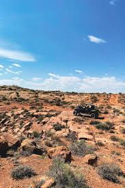
Skinwalker Ranch is located at 40.2549 degrees North, 109.8864 degrees West, in Uintah County, Utah, southeast of Ballard. It is 512 acres on the edge of the Uintah and Ouray Indian Reservation.
The answer is yes. And the geology is more layered than a simple yes conveys.
The Utah Geological Survey documents that the rocks now making up the Uinta Mountains formed when sediment collected in a failed rift, a tectonic spreading center, approximately 750 to 770 million years ago. A fault-bounded basin subsided and filled with material totaling more than 10,000 feet thick. [Utah Geological Survey, The Uinta-Tooele Structural Zone, geology.utah.gov/map-pub/survey-notes/the-uinta-tooele-structural-zone-whats-in-a-name]
Skinwalker Ranch does not sit on the mountains. It sits in the Uinta Basin, the geological subsidence zone created directly south of that ancient failed rift as the mountains rose. The basin is the geological product of the rift architecture.
The Duchesne Fault Zone runs through the county. Published research describes it as a 40-mile-long series of east-west trending high-angle fault segments with individual normal faults with throws of up to 600 feet. [Uinta Enigma: The Duchesne Fault Zone, Rocky Mountain Association of Geologists, 2021, available via academia.edu. Also confirmed by: Surface and Subsurface Mapping of the Duchesne Fault Zone, Earth and Planetary Science, March 2026, journals.nasspublishing.com]
The Utah Geological Survey has documented through 15 years of detailed mapping that the Uinta Mountains have large active faults that may present a current earthquake hazard. [Utah Geological Survey, The Uinta Mountains: A Tale of Two Geographies, geology.utah.gov/map-pub/survey-notes/uinta-mountains-two-geographies]
The eastern Uinta Basin where the ranch sits is at the transition zone between two major tectonic systems simultaneously. To the north and east, the Laramide thrust belt. To the south and west, the Basin and Range extensional province. The ranch sits at the geological boundary between these two systems.
The research team at the property has documented anomalous electromagnetic readings, unusual subsurface features, and unexplained sensor responses across multiple seasons of investigation. We are not in a position to evaluate those specific claims. What we can say, based entirely on publicly available Utah Geological Survey data, is that a property sitting on a failed rift basin, bounded by active fault systems, at the intersection of two major tectonic regimes, in a region with documented basement rock anomalies, is going to produce measurable geophysical readings that differ from surrounding terrain.
The geology does not explain the lights in the sky or the reported cattle incidents. But it does provide a documented physical basis for why electromagnetic sensors at that location would behave differently than they would anywhere else in the county. That is worth knowing.
The Full Picture
When we published part one, the documented pattern covered four military facilities across three states. As of this article, the same pattern covers those four military facilities, twelve major commercial data center clusters across nine states, and one of the most researched anomalous locations in American history.
Every single one sits on a rift zone.
The pattern is stronger for the eastern US data center clusters and the military facilities, where the rift zones are specific narrow features surrounded by stable craton geology. It requires more interpretive caution for the western US clusters where faulting is more widespread. We are being transparent about that distinction rather than overstating the case.
What does not require interpretive caution is the Ohio overlap. Google, Microsoft, and WPAFB all independently on the East Continent Rift Basin. The Rio Grande Rift, the most electromagnetically active corridor, has the most concentrated military nuclear infrastructure and zero commercial data center development. Those two facts together are the sharpest points in this research and neither depends on resolving the western US question.
The research continues. The FCC Ashburn searches will be completed. The full investigation into the Zorro Ranch communications infrastructure, the scientist pipeline, and the forty-year pattern of documented investigation shutdowns is coming in a July episode. The New Mexico Truth Commission releases its first report on July 31, 2026.
Subscribe so you do not miss it. And if you have a question that pulls this research somewhere new, ask it. The two questions that came in after part one moved this forward significantly.
Sources
All sources are publicly accessible.
Geology: Culpeper Basin Wikipedia: Culpeper Basin (citing USGS Professional Paper 1472 and GSA Bulletin research): en.wikipedia.org/wiki/Culpeper_Basin USGS: Triassic-Jurassic Stratigraphy of the Culpeper and Barboursville Basins: usgs.gov/publications/triassic-jurassic-stratigraphy-culpeper-and-barboursville-basins-virginia-and-maryland USGS CIRC 1264, Regional Tectonic History, Northern Virginia field trip: pubs.usgs.gov/circ/2004/1264/html/trip1
Geology: Rio Grande Rift and New Mexico Faults USGS Quaternary Fault and Fold Database: usgs.gov/programs/earthquake-hazards/faults
Geology: Skinwalker Ranch and Uinta Basin Utah Geological Survey, The Uinta-Tooele Structural Zone: geology.utah.gov/map-pub/survey-notes/the-uinta-tooele-structural-zone-whats-in-a-name
Utah Geological Survey, Uinta Mountains: A Tale of Two Geographies: geology.utah.gov/map-pub/survey-notes/uinta-mountains-two-geographies Uinta Enigma: The Duchesne Fault Zone, Rocky
Mountain Association of Geologists: academia.edu/48746296/Uinta_Enigma_The_Duchesne_Fault_Zone Surface and Subsurface Mapping of the Duchesne Fault Zone, March 2026: journals.nasspublishing.com/index.php/eps/article/view/3063
Geology: Midcontinent Rift and East Continent Rift USGS, Geophysics of the Midcontinent Rift Region: usgs.gov/centers/gggsc/science/geophysics-midcontinent-rift-region Drahovzal et al., 1992, East Continent Rift Basin, Kentucky Geological Survey Information Circular 3: uky.edu/KGS
Geology: Craton stability and US stable zones Geosciences LibreTexts, Cratons and Shields: geo.libretexts.org USGS, Geology of the United States: en.wikipedia.org/wiki/Geology_of_the_United_States MIT News, North American craton stability: news.mit.edu/2011/stable-continents-0106
Project ELF Wikipedia: Project Sanguine (citing declassified Navy specifications): en.wikipedia.org/wiki/Project_Sanguine NCBI Bookshelf, Evaluation of the US Navy ELF Communications System: ncbi.nlm.nih.gov/books/NBK233163 ELF Station Republic MI, Military History of the Upper Great Lakes: ss.sites.mtu.edu/mhugl/2015/10/10/elf-sta-republic-mi
Ashburn internet traffic TeleGeography analysis via DGTL Infra: dgtlinfra.com/data-centers-virginia-ashburn-loudoun WTOP News, Northern Virginia data center markets: wtop.com/business-finance/2022/01/n-virginia-still-tops-global-data-center-markets-and-whats-a-gigawatt Cardinal News, fact-check of 70 percent claim: cardinalnews.org/2025/07/29/the-famous-claim-that-70-of-the-worlds-internet-traffic-goes-through-northern-virginia-is-wrong
FCC License Records CoreSite licenses WQXN238, WQXN242, WQXN245, WRFY987, WRYX787: wireless2.fcc.gov/UlsApp/UlsSearch Zorro Ranch licenses WQXY316, WQXY300: fcc.gov/licensing/database/search
Atlanta data center growth CBRE North America Data Center Trends H2 2024: cbre.com
DOJ Epstein files justice.gov/epstein/search epsteinexposed.com
This is part two of an ongoing investigation. The full episode covering the complete research is in production for release in late May 2026. The July episode will cover the Zorro Ranch communications infrastructure, the scientist pipeline, and forty years of documented investigation shutdowns following the July 31 Truth Commission report.
Episode will drop on Patreon later this week!


Comments